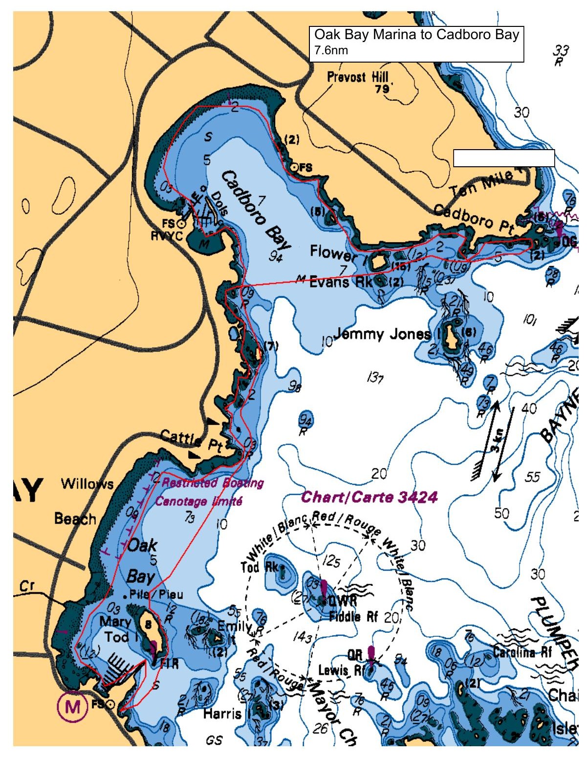
The plan is to head out from Oak Bay marina north to Cadbury Bay. The idea is to 'noodle' the coastline, taking it slow and easy, and trying to see as much wildlife in the intertidal as we can. Now, we do not have a nature guide, but I have done this before, and although I may not have all the answers to all the questions, we should find this paddle relaxing and interesting. As the plot shows, we will launch at the small bay with stairs at the back end of the parking lot.
Route plan B
As this paddle should not be fetched by anything other than gale force winds, if we have to do an alternate, it will be the Gorge waterway, guaranteed wind-proof, and still in the 'relaxed' area of paddling.
Safety reminders
Always dress for the possibility of immersion and please bring a drybag containing a spare change of clothes. The drybag goes in your kayak with you, not in your car at the launch site. Please bring a lunch or snacks and sufficient beverage to keep you hydrated, as well as a thermos of something warm. Your paddle leader will introduce the plan and make sure everyone is comfortable with the requirements. Please stay off the water until the group is ready. If you have a VHF radio please bring it with you.
SISKA · Paddle · Relaxed
Printed Nov 9, 2026 10:59 AM · siska.ca/activities/1394
Oak Bay Marina to Intertidal - EXPLORATION
Sunday, July 2, 2023 · 9:30 AM – 3:30 PM
Launch
Oak Bay MarinaOak Bay Marina
Destination
Intertidal
Distance
7.6 nm
Leader
Rod Stiebel
Route plan A
The plan is to head out from Oak Bay marina north to Cadbury Bay. The idea is to 'noodle' the coastline, taking it slow and easy, and trying to see as much wildlife in the intertidal as we can. Now, we do not have a nature guide, but I have done this before, and although I may not have all the answers to all the questions, we should find this paddle relaxing and interesting. As the plot shows, we will launch at the small bay with stairs at the back end of the parking lot.
Route plan B
As this paddle should not be fetched by anything other than gale force winds, if we have to do an alternate, it will be the Gorge waterway, guaranteed wind-proof, and still in the 'relaxed' area of paddling.
Route map
Oak Bay Marina to Intertidal - EXPLORATION · Sunday, July 2, 2023