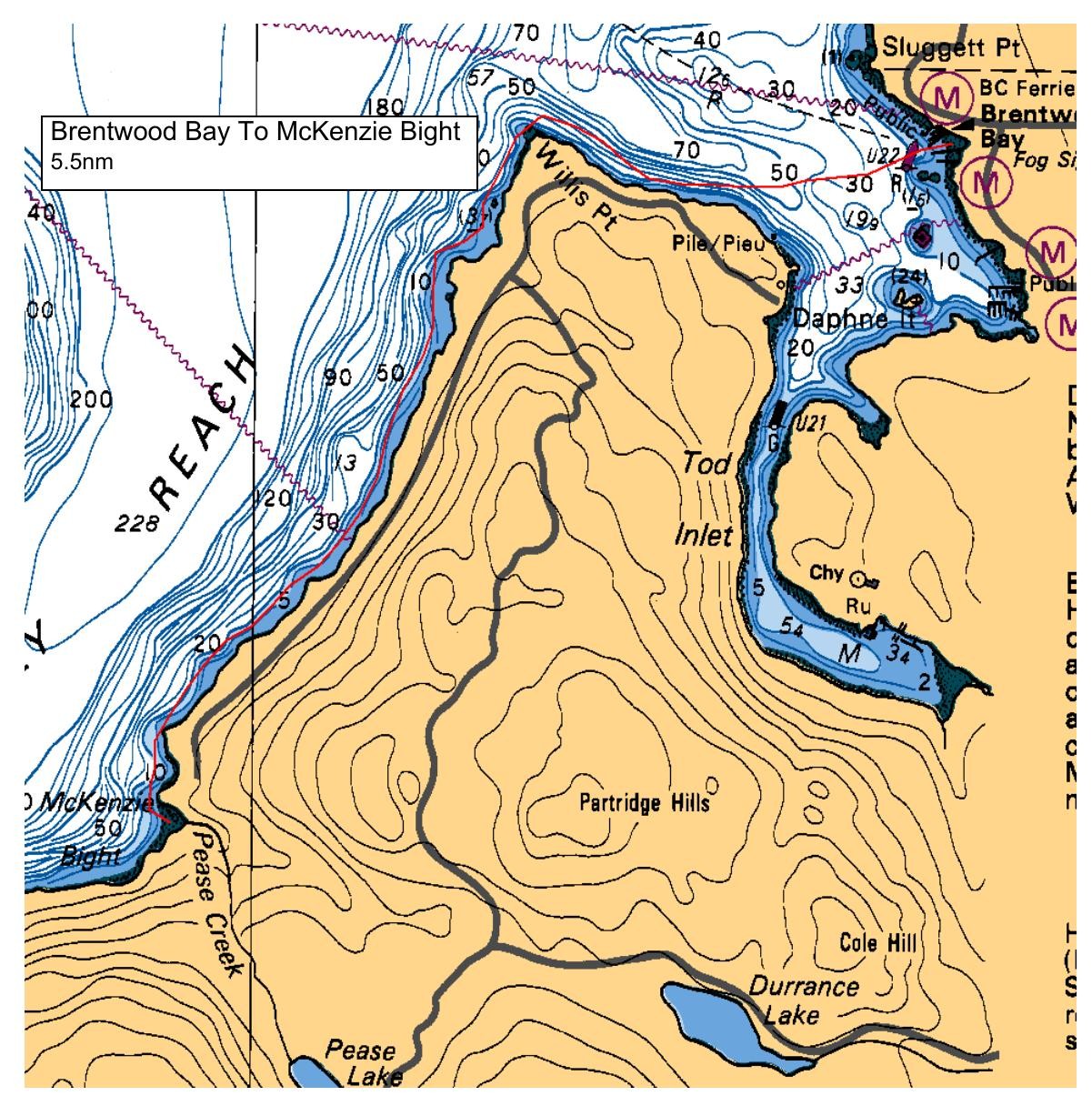
.. Heading South West from the Brentwood ferry launch site we'll paddle across and along the shore to Willis Pt. and then South to Mackenzie Bight for lunch and after lunch we will retrace our route back to our Brentwood launch site. This paddle will be separated into two pods of 6 paddlers each.. No more paddlers will be accepted unless paddlers cancel. ( I'm keeping a wait list ) ... Scroll down!!
Unload your kayak and gear at the Verdier park parking area and move your vehicle to either; the parking area in front of the Brentwood pub or in theBrentwood Pub parking lot across the street at the back, near the trees. Walk your kayaks down the path located on the left hand side of the Verdier Park bathrooms to the beach.
Cheers!... Heather
Route plan B
Dependent on wind forecast..
Safety reminders
Always dress for the possibility of immersion and please bring a drybag containing a spare change of clothes. The drybag goes in your kayak with you, not in your car at the launch site. Please bring a lunch or snacks and sufficient beverage to keep you hydrated, as well as a thermos of something warm. Your paddle leader will introduce the plan and make sure everyone is comfortable with the requirements. Please stay off the water until the group is ready. If you have a VHF radio please bring it with you.
SISKA · Paddle · Relaxed
Printed Oct 31, 2026 11:40 PM · siska.ca/activities/1163
Brentwood Bay Ferry Wharf to McKenzie Bight
Saturday, August 29, 2020 · 9:30 AM – 3:30 PM
Launch
Brentwood Bay Ferry WharfVerdier Avenue, British Columbia
Destination
McKenzie Bight
Distance
5.5 nm
Leader
Heather Jones
Route plan A
.. Heading South West from the Brentwood ferry launch site we'll paddle across and along the shore to Willis Pt. and then South to Mackenzie Bight for lunch and after lunch we will retrace our route back to our Brentwood launch site. This paddle will be separated into two pods of 6 paddlers each.. No more paddlers will be accepted unless paddlers cancel. ( I'm keeping a wait list ) ... Scroll down!!
Unload your kayak and gear at the Verdier park parking area and move your vehicle to either; the parking area in front of the Brentwood pub or in theBrentwood Pub parking lot across the street at the back, near the trees. Walk your kayaks down the path located on the left hand side of the Verdier Park bathrooms to the beach.
Cheers!... Heather
Route plan B
Dependent on wind forecast..
Route map
Brentwood Bay Ferry Wharf to McKenzie Bight · Saturday, August 29, 2020