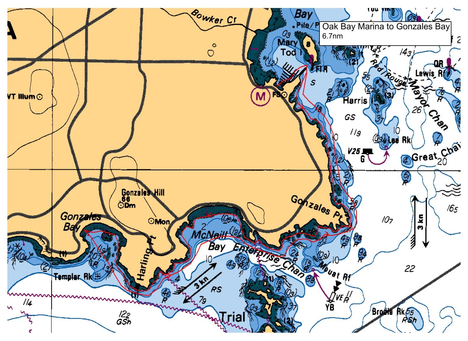
Launch from Oak Bay Marina, and launch at beach area by the far end of parking lot, down the stairs, south end. We will noodle down the shoreline, past the golf course, to Gonzales Bay. If the group agrees, we can cut this shorter to McNeil bay, if waters are rougher etc. More on day of paddle. Tides will be VERY low at launch, and will be flooding for 90% of our paddle. We will make a lunch stop at Gonzales, washroom break etc. This is not typical of a 'light' designation, but the distance is. We hope to be off water by 2:00 at latest, with a lunch stop, all depends on the group.
Route plan B
All depends on winds, possibly go opposite direction towards Caddy Bay.
Safety reminders
Always dress for the possibility of immersion and please bring a drybag containing a spare change of clothes. The drybag goes in your kayak with you, not in your car at the launch site. Please bring a lunch or snacks and sufficient beverage to keep you hydrated, as well as a thermos of something warm. Your paddle leader will introduce the plan and make sure everyone is comfortable with the requirements. Please stay off the water until the group is ready. If you have a VHF radio please bring it with you.
SISKA · Paddle · Light
Printed Nov 9, 2026 11:21 AM · siska.ca/activities/1230
Oak Bay Marina to Shoreline Exploration
Saturday, June 26, 2021 · 9:30 AM – 3:30 PM
Launch
Oak Bay MarinaOak Bay Marina
Destination
Shoreline Exploration
Distance
6.7 nm
Leader
Rod Stiebel
Route plan A
Launch from Oak Bay Marina, and launch at beach area by the far end of parking lot, down the stairs, south end. We will noodle down the shoreline, past the golf course, to Gonzales Bay. If the group agrees, we can cut this shorter to McNeil bay, if waters are rougher etc. More on day of paddle. Tides will be VERY low at launch, and will be flooding for 90% of our paddle. We will make a lunch stop at Gonzales, washroom break etc. This is not typical of a 'light' designation, but the distance is. We hope to be off water by 2:00 at latest, with a lunch stop, all depends on the group.
Route plan B
All depends on winds, possibly go opposite direction towards Caddy Bay.
Route map
Oak Bay Marina to Shoreline Exploration · Saturday, June 26, 2021