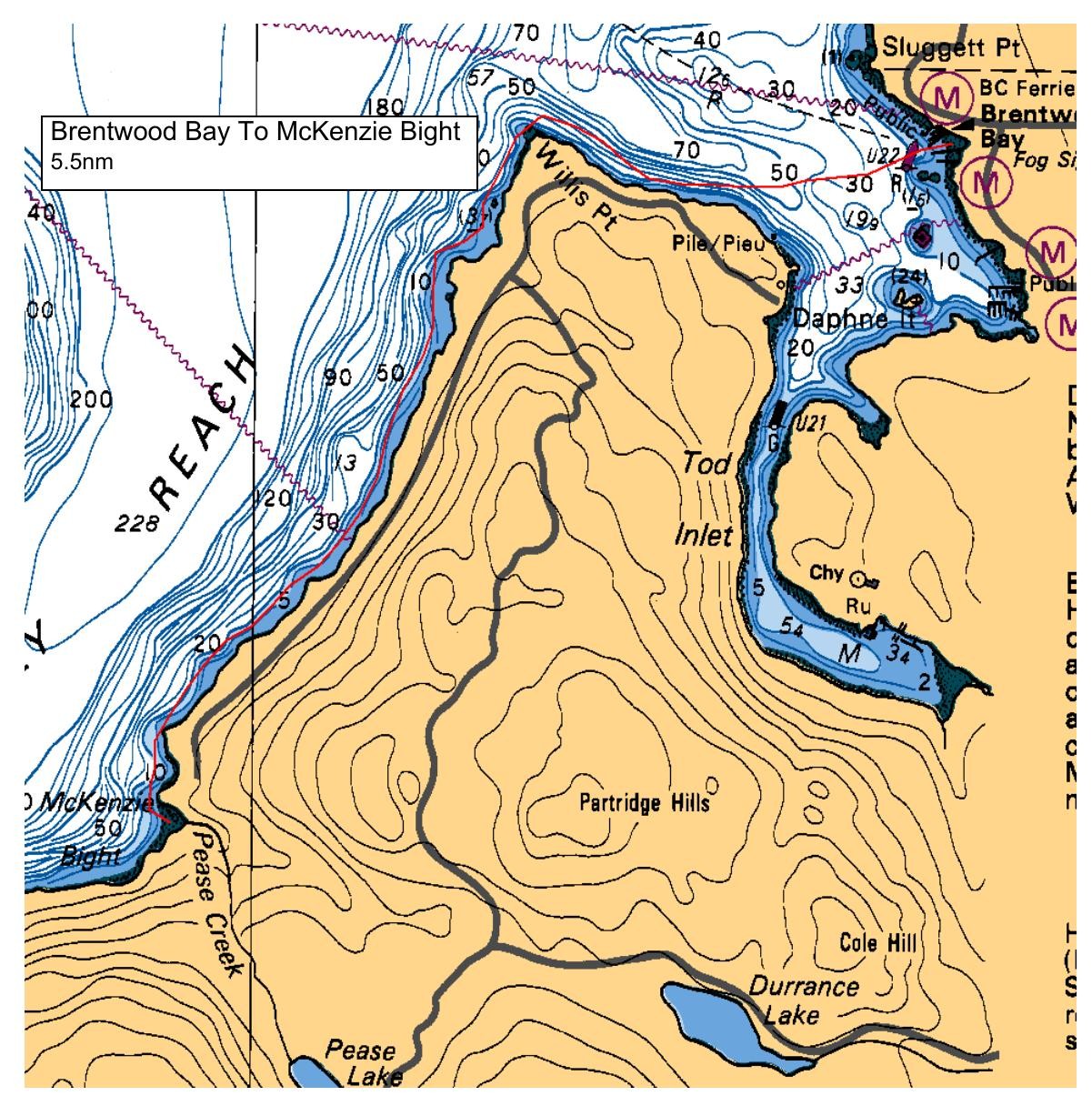
We will launch at the small beach at the bottom of Verdier Ave, just before the ferry wharf. The tides will be quite low, so there should be room for 10 paddlers to space out. It may be best to assemble your kayak and gear on the lawn in front of the washrooms. We will paddle out at a relaxed pace towards Willis Point round to Mckenzie Bight, for lunch stop. There is a pit toilet up the trail, we will probably see quite a few hikers. If time permits, on our way back to Brentwood Bay, we can detour into Todd inlet for a quieter bit of noodling, if time and energy allows. This could happen on the way out, when we may have more energy!
Route plan B
Hoping winds don't spoil our plans, no real plan 'B',other than a shorter trip up Todd inlet, staying in more protected waters.
Safety reminders
Always dress for the possibility of immersion and please bring a drybag containing a spare change of clothes. The drybag goes in your kayak with you, not in your car at the launch site. Please bring a lunch or snacks and sufficient beverage to keep you hydrated, as well as a thermos of something warm. Your paddle leader will introduce the plan and make sure everyone is comfortable with the requirements. Please stay off the water until the group is ready. If you have a VHF radio please bring it with you.
SISKA · Paddle · Relaxed
Printed Nov 9, 2026 11:21 AM · siska.ca/activities/1236
Brentwood Bay Ferry Wharf to McKenzie Bight
Saturday, July 24, 2021 · 9:30 AM – 3:30 PM
Launch
Brentwood Bay Ferry WharfVerdier Avenue, British Columbia
Destination
McKenzie Bight
Distance
5.5 nm
Leader
Rod Stiebel
Route plan A
We will launch at the small beach at the bottom of Verdier Ave, just before the ferry wharf. The tides will be quite low, so there should be room for 10 paddlers to space out. It may be best to assemble your kayak and gear on the lawn in front of the washrooms. We will paddle out at a relaxed pace towards Willis Point round to Mckenzie Bight, for lunch stop. There is a pit toilet up the trail, we will probably see quite a few hikers. If time permits, on our way back to Brentwood Bay, we can detour into Todd inlet for a quieter bit of noodling, if time and energy allows. This could happen on the way out, when we may have more energy!
Route plan B
Hoping winds don't spoil our plans, no real plan 'B',other than a shorter trip up Todd inlet, staying in more protected waters.
Route map
Brentwood Bay Ferry Wharf to McKenzie Bight · Saturday, July 24, 2021