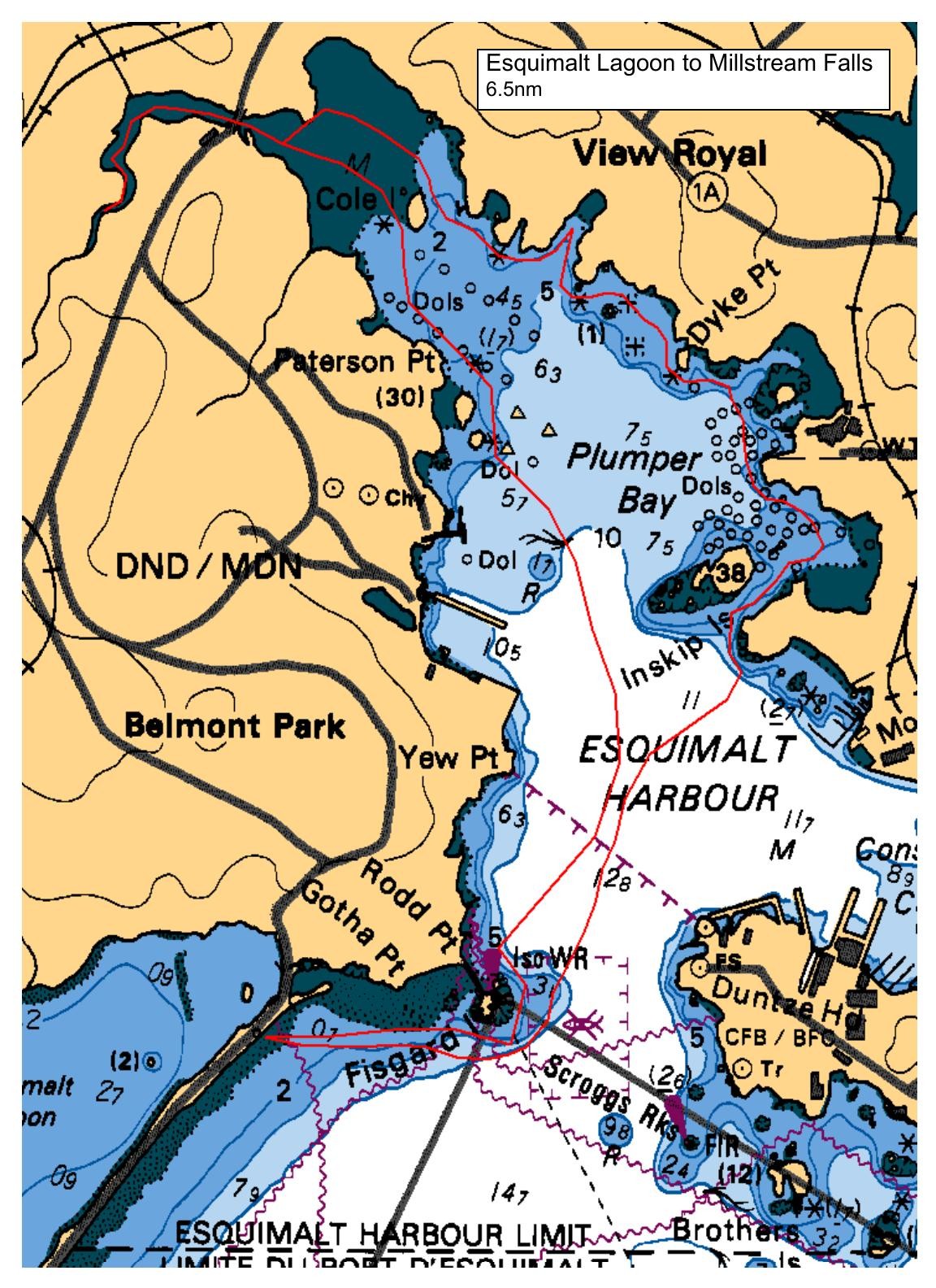
We'll be launching on the ocean side of Esquimalt Lagoon near to the washrooms at the SW end of the lagoon (corner of Lagoon and Ocean Blvd roads). From there we'll paddle past Fort Rodd Hill and enter Esquimalt Harbour. We'll give a courtesy radio call to the Queens Harbour Master and paddle to Smart Island, then into Millstream Creek and finally to the falls, which should be running hard with the winter rains. We'll leave the falls and noodle the north side of the shore (maybe take a small detour to paddle thru the powder magazines at Cole Island ?). Lunch at the Portage Cove beach. After lunch, we'll continue along the shore, check in again with the Queens Harbour Master, paddle out of the harbour, and then back to Esquimalt Lagoon.
Route plan B
The paddle was moved to Telegraph Bay to Cormorant Point on account of the SW wind forecast.
Safety reminders
Always dress for the possibility of immersion and please bring a drybag containing a spare change of clothes. The drybag goes in your kayak with you, not in your car at the launch site. Please bring a lunch or snacks and sufficient beverage to keep you hydrated, as well as a thermos of something warm. Your paddle leader will introduce the plan and make sure everyone is comfortable with the requirements. Please stay off the water until the group is ready. If you have a VHF radio please bring it with you.
SISKA · Paddle · Relaxed
Printed Nov 9, 2026 11:21 AM · siska.ca/activities/1266
Esquimalt Lagoon to Millstream Falls
Monday, January 3, 2022 · 9:30 AM – 3:30 PM
Cancelled
Launch
Esquimalt LagoonCoburg Pennisula
Destination
Millstream Falls
Distance
6.5 nm
Leader
Mike Teachman
Route plan A
We'll be launching on the ocean side of Esquimalt Lagoon near to the washrooms at the SW end of the lagoon (corner of Lagoon and Ocean Blvd roads). From there we'll paddle past Fort Rodd Hill and enter Esquimalt Harbour. We'll give a courtesy radio call to the Queens Harbour Master and paddle to Smart Island, then into Millstream Creek and finally to the falls, which should be running hard with the winter rains. We'll leave the falls and noodle the north side of the shore (maybe take a small detour to paddle thru the powder magazines at Cole Island ?). Lunch at the Portage Cove beach. After lunch, we'll continue along the shore, check in again with the Queens Harbour Master, paddle out of the harbour, and then back to Esquimalt Lagoon.
Route plan B
The paddle was moved to Telegraph Bay to Cormorant Point on account of the SW wind forecast.
Route map
Esquimalt Lagoon to Millstream Falls · Monday, January 3, 2022