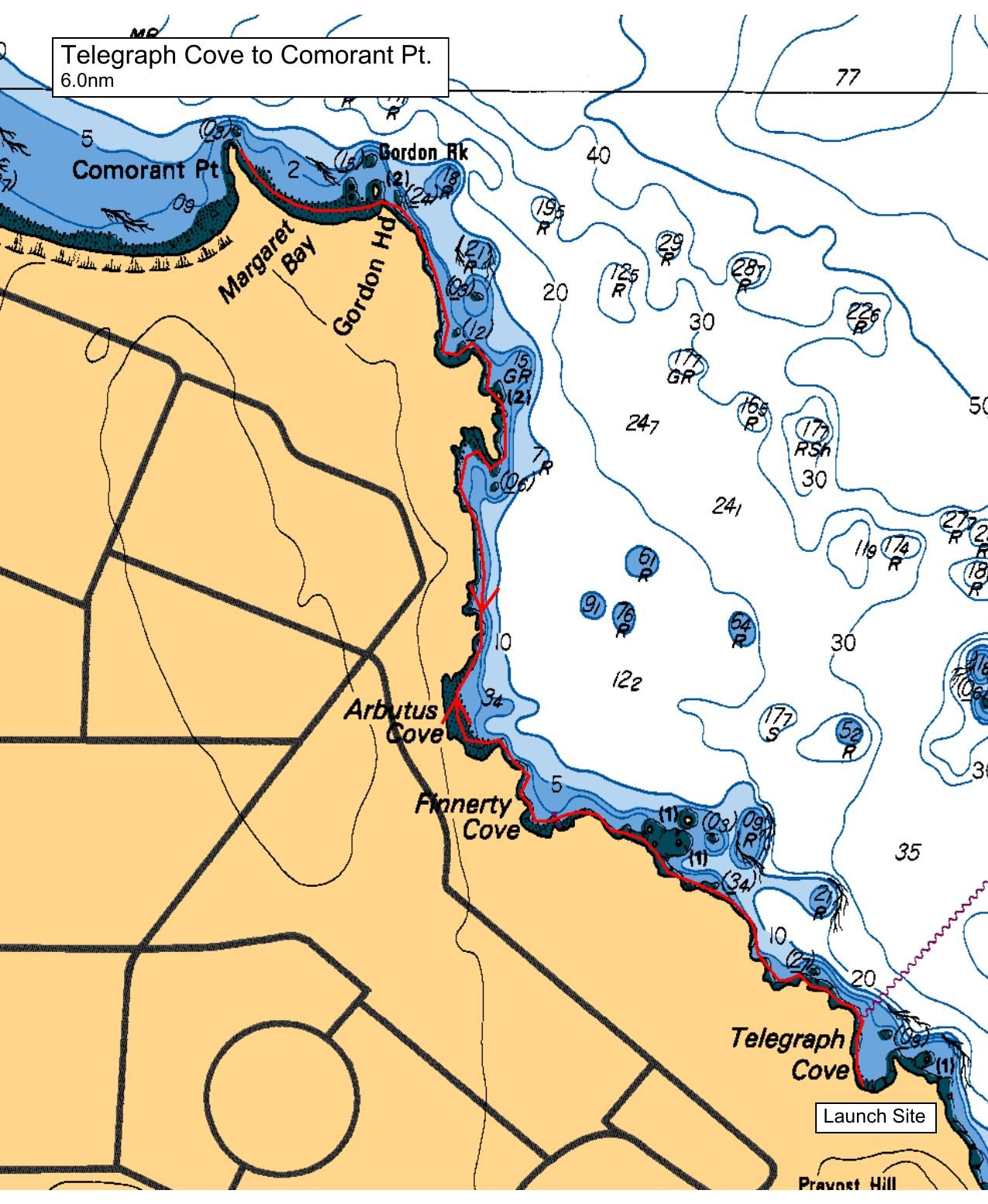
This trip is rated Energizer as there will be a snappy ebb current to combat as the group paddles toward Cormorant Point.
Meet at the parking at the end of Telegraph Bay Road. Our shoreline route will be mostly protected from westerly winds as we make our way past Margaret’s Bay, Finnerty and Glencoe Coves, and around the various rocky headlands. We'll land for lunch at the beach at Cormorant Point and return using the same route.
Options to extend this paddle by approx. 2 nm: Begin by paddling south to Ten Mile Point, then push back along the coast (approx. 2 knot ebb). Or, after lunch head out to Zero Rock and cruise back with the Ebb (wind and sea state dependent). Or we can stick with the paddle as listed. These options will be discussed at our beach talk.
Route plan B
TBA
Safety reminders
Always dress for the possibility of immersion and please bring a drybag containing a spare change of clothes. The drybag goes in your kayak with you, not in your car at the launch site. Please bring a lunch or snacks and sufficient beverage to keep you hydrated, as well as a thermos of something warm. Your paddle leader will introduce the plan and make sure everyone is comfortable with the requirements. Please stay off the water until the group is ready. If you have a VHF radio please bring it with you.
SISKA · Paddle · Energizer
Printed Nov 9, 2026 11:13 AM · siska.ca/activities/1349
Telegraph Cove to Cormorant Point
Saturday, January 14, 2023 · 9:30 AM – 3:30 PM
Launch
Telegraph Cove4040 Lockehaven Dr
Destination
Cormorant Point
Distance
6 nm
Leader
Joanne Nicolson
Route plan A
This trip is rated Energizer as there will be a snappy ebb current to combat as the group paddles toward Cormorant Point.
Meet at the parking at the end of Telegraph Bay Road. Our shoreline route will be mostly protected from westerly winds as we make our way past Margaret’s Bay, Finnerty and Glencoe Coves, and around the various rocky headlands. We'll land for lunch at the beach at Cormorant Point and return using the same route.
Options to extend this paddle by approx. 2 nm: Begin by paddling south to Ten Mile Point, then push back along the coast (approx. 2 knot ebb). Or, after lunch head out to Zero Rock and cruise back with the Ebb (wind and sea state dependent). Or we can stick with the paddle as listed. These options will be discussed at our beach talk.
Route plan B
TBA
Route map
Telegraph Cove to Cormorant Point · Saturday, January 14, 2023