SISKA · Paddle · Energizer
Moses Point to Russell Island
Saturday, April 15, 2023 · 9:30 AM – 3:30 PM
- Launch
- Moses PointMoses Point Road, North Saanich
- Destination
- Russell Island
- Distance
- 11 nm
- Leader
- Konrad Sechley
Route plan A
Moses Point lies at the end of Moses Point Road in North Saanich. A 100 meter trail ends with several steps leading to a rocky shell and gravel beach. There is parking along Moses Point Road, but parking can be tight, therefore the maximum number of paddlers is 6.
Kayak wheels are recommended to transport your kayak down the trail from the parking area to the launch site.
Please bring a lunch and a change of clothes, should they be needed. Also, make sure to wear appropriate immersion gear.
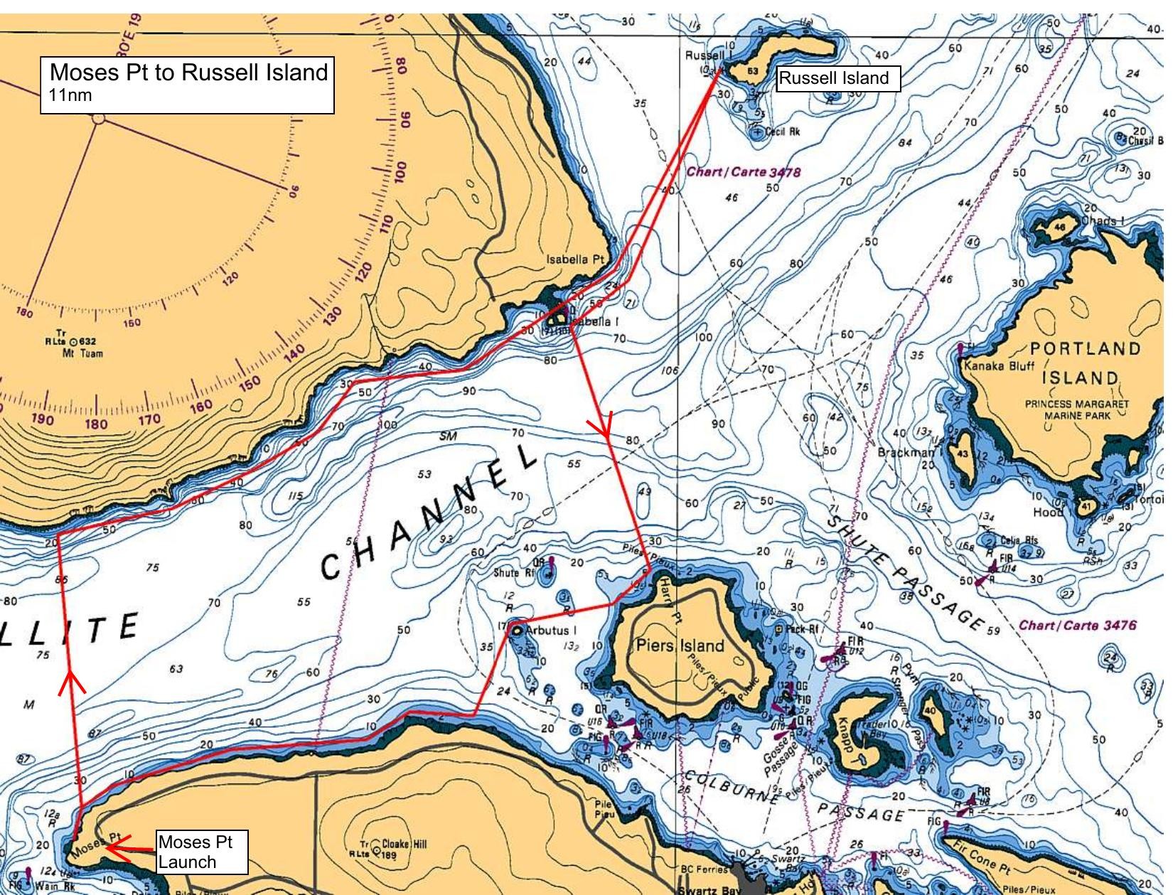
From Moses Point we will cross Satellite Channel to SaltSpring Island and follow the southern shore towards Isabella Island (an ecological reserve). We will then cross Fulford Harbour to Russell Island.
We will land on the west end of Russell Island for lunch, and we will have time to explore the garden, orchard and the area around Mahoi house (the house is not open at this time). Russell Island is part of the Gulf Islands National Park Reserve.
On our return route, we will paddle back to Isabella Point and handrail a portion of the southern shore of SaltSpring, cross the Satellite Channel and follow the northern shore of the Saanich Peninsula to Moses Point.
For further information on Hawaiian settlement on Russell Island see: https://www.pc.gc.ca/en/pn-np/bc/gulf/culture/hawaienne-hawaiian
Route plan B
An alternate paddle is to follow the shoreline south of Moses Point, past Deep Cove and Patricia Bay to Coles Bay, and return.
Route map
Moses Point to Russell Island · Saturday, April 15, 2023