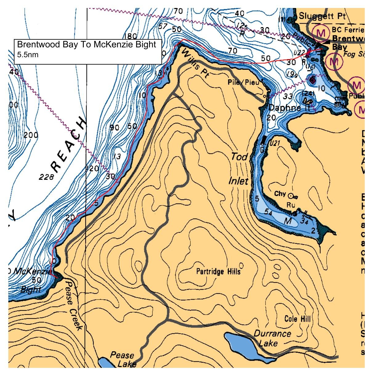
We will launch from the beach down the slight ramp at the end of Verdier Avenue (just before the ferry). From there we can tour Tod Inlet and then come back out and around Willis Point. Travelling along the shoreline we'll reach Mackenzie Bight for our lunch break. After lunch we can head straight back to the launch site, or as an option to add distance, do a quick loop of Sensasus Island for those keeners (and if we have a second leader). Total distance is about 7.5 nm. Please note that the plot doesn't show the initial trip in to Tod Inlet which adds about 2nm to the 5.5 to the Bight and back directly.
Route plan B
Plan B is to stay along the shoreline north of the ferry terminal. We will make this decision after touring Tod Inlet.
Safety reminders
Always dress for the possibility of immersion and please bring a drybag containing a spare change of clothes. The drybag goes in your kayak with you, not in your car at the launch site. Please bring a lunch or snacks and sufficient beverage to keep you hydrated, as well as a thermos of something warm. Your paddle leader will introduce the plan and make sure everyone is comfortable with the requirements. Please stay off the water until the group is ready. If you have a VHF radio please bring it with you.
SISKA · Paddle · Relaxed
Printed Nov 9, 2026 11:13 AM · siska.ca/activities/1470
Brentwood Bay Ferry Wharf to McKenzie Bight - RAFT UP
Sunday, June 2, 2024 · 9:30 AM – 3:30 PM
Launch
Brentwood Bay Ferry WharfVerdier Avenue, British Columbia
Destination
McKenzie Bight
Distance
7.5 nm
Leader
Tim Frick
Route plan A
We will launch from the beach down the slight ramp at the end of Verdier Avenue (just before the ferry). From there we can tour Tod Inlet and then come back out and around Willis Point. Travelling along the shoreline we'll reach Mackenzie Bight for our lunch break. After lunch we can head straight back to the launch site, or as an option to add distance, do a quick loop of Sensasus Island for those keeners (and if we have a second leader). Total distance is about 7.5 nm. Please note that the plot doesn't show the initial trip in to Tod Inlet which adds about 2nm to the 5.5 to the Bight and back directly.
Route plan B
Plan B is to stay along the shoreline north of the ferry terminal. We will make this decision after touring Tod Inlet.
Route map
Brentwood Bay Ferry Wharf to McKenzie Bight - RAFT UP · Sunday, June 2, 2024