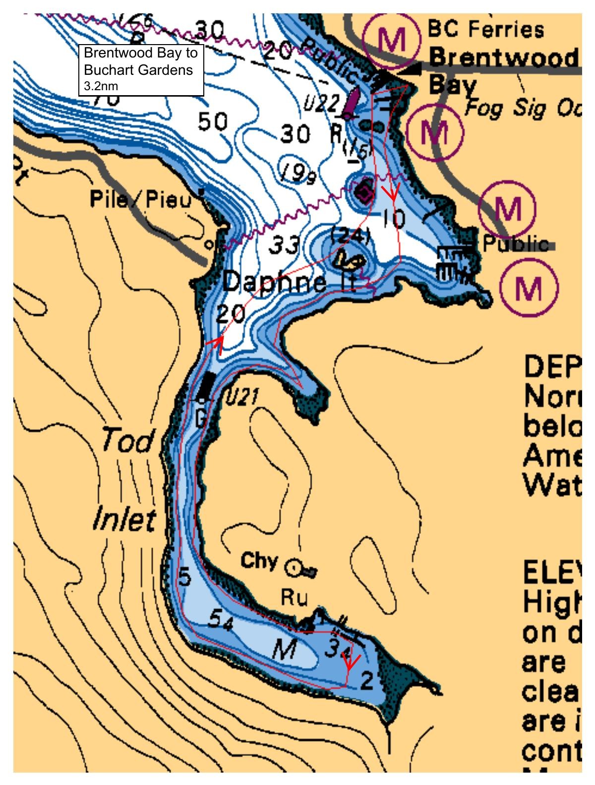
A short noodling paddle going south from Brentwood Bay ferry dock beach behind Daphne Islet, through Butchart Cove, and down to the end of Tod Inlet and back to the beach at Brentwood Bay ferry dock. Paddle should take between 90 and 120 minutes, round trip. There are washrooms at the launch and (I believe) at the 'Nature Hut Wharf' beach in Tod Inlet. Due to the very short nature of this paddle no stops are planned - bring a snack if you need one and liquids to maintain hydration. The tide is ebbing during the paddle time (2.0M at 10:00am to 1.5M at 12:00pm), and current is rarely a factor paddling in Saanich Inlet. Wind conditions can affect Brentwood Bay but Tod Inlet is quite well protected.
Route plan B
TBD
Safety reminders
Always dress for the possibility of immersion and please bring a drybag containing a spare change of clothes. The drybag goes in your kayak with you, not in your car at the launch site. Please bring a lunch or snacks and sufficient beverage to keep you hydrated, as well as a thermos of something warm. Your paddle leader will introduce the plan and make sure everyone is comfortable with the requirements. Please stay off the water until the group is ready. If you have a VHF radio please bring it with you.
SISKA · Paddle · Light
Printed Nov 9, 2026 11:21 AM · siska.ca/activities/1480
Brentwood Bay Ferry Wharf to Tod Inlet
Thursday, July 11, 2024 · 9:30 AM – 3:30 PM
Launch
Brentwood Bay Ferry WharfVerdier Avenue, British Columbia
Destination
Tod Inlet
Distance
3.2 nm
Leader
Craig Thomson
Route plan A
A short noodling paddle going south from Brentwood Bay ferry dock beach behind Daphne Islet, through Butchart Cove, and down to the end of Tod Inlet and back to the beach at Brentwood Bay ferry dock. Paddle should take between 90 and 120 minutes, round trip. There are washrooms at the launch and (I believe) at the 'Nature Hut Wharf' beach in Tod Inlet. Due to the very short nature of this paddle no stops are planned - bring a snack if you need one and liquids to maintain hydration. The tide is ebbing during the paddle time (2.0M at 10:00am to 1.5M at 12:00pm), and current is rarely a factor paddling in Saanich Inlet. Wind conditions can affect Brentwood Bay but Tod Inlet is quite well protected.
Route plan B
TBD
Route map
Brentwood Bay Ferry Wharf to Tod Inlet · Thursday, July 11, 2024