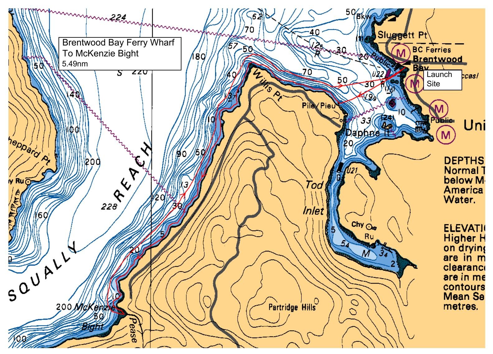
We'll launch from the parkside beach located just south of the Brentwood Bay ferry terminal (near the foot of Verdier Ave).
There are washrooms located next to the small parking lot at the park.
Please unload and move your vehicle a bit further away so as not to impede other park users or the ferry lineup.
We'll make the short crossing to Willis Point and handrail along the east shore of Saanich Inlet to reach our lunch stop at Mackenzie Bight.
Reversing course, we'll paddle back to Brentwood Bay, with a possible short excursion into Todd Inlet if the energy level permits.
Route plan B
TBA
Safety reminders
Always dress for the possibility of immersion and please bring a drybag containing a spare change of clothes. The drybag goes in your kayak with you, not in your car at the launch site. Please bring a lunch or snacks and sufficient beverage to keep you hydrated, as well as a thermos of something warm. Your paddle leader will introduce the plan and make sure everyone is comfortable with the requirements. Please stay off the water until the group is ready. If you have a VHF radio please bring it with you.
SISKA · Paddle · Relaxed
Printed Nov 9, 2026 11:21 AM · siska.ca/activities/1482
Brentwood Bay Ferry Wharf to McKenzie Bight - NEW MEMBERS
Sunday, July 14, 2024 · 9:30 AM – 3:30 PM
Launch
Brentwood Bay Ferry WharfVerdier Avenue, British Columbia
Destination
McKenzie Bight
Distance
5.5 nm
Leader
Anton Cepeliauskas
Route plan A
We'll launch from the parkside beach located just south of the Brentwood Bay ferry terminal (near the foot of Verdier Ave).
There are washrooms located next to the small parking lot at the park.
Please unload and move your vehicle a bit further away so as not to impede other park users or the ferry lineup.
We'll make the short crossing to Willis Point and handrail along the east shore of Saanich Inlet to reach our lunch stop at Mackenzie Bight.
Reversing course, we'll paddle back to Brentwood Bay, with a possible short excursion into Todd Inlet if the energy level permits.
Route plan B
TBA
Route map
Brentwood Bay Ferry Wharf to McKenzie Bight - NEW MEMBERS · Sunday, July 14, 2024