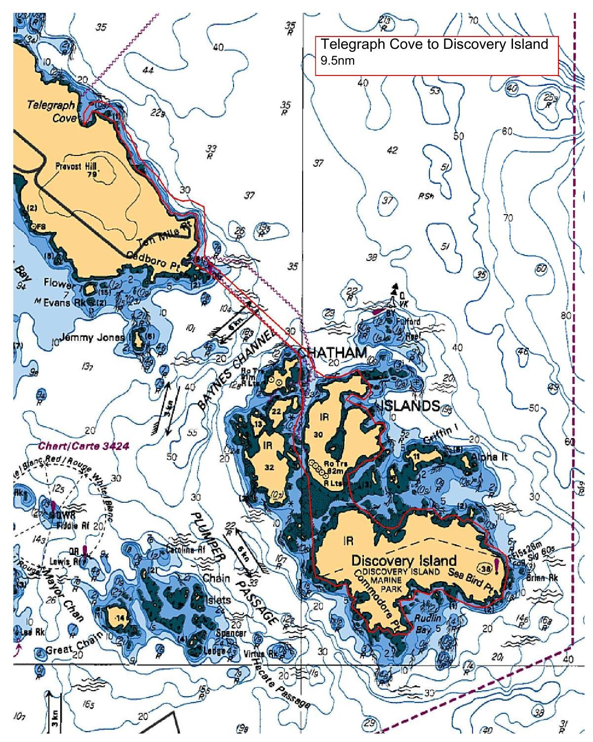
We will launch at Telegraph Cove and take advantage of the morning ebb to paddle over to Chatham Islands making our way along the shoreline to Rudlin Bay for a lunch break and perhaps a leisurely hike for those seeking to explore. We will catch the end of the ebb current and the beginning of the flood current on our way back to Telegraph Cove. This paddle is approximately 9.5nm and depending on the winds, we may encounter some bumpy conditions. If winds, do not cooperate, we will have a Plan B TBD.
Route plan B
Plan B will have us launching at Moses Point and heading to Pat Bay, where we will stop for lunch before returning to Moses Point.
Safety reminders
Always dress for the possibility of immersion and please bring a drybag containing a spare change of clothes. The drybag goes in your kayak with you, not in your car at the launch site. Please bring a lunch or snacks and sufficient beverage to keep you hydrated, as well as a thermos of something warm. Your paddle leader will introduce the plan and make sure everyone is comfortable with the requirements. Please stay off the water until the group is ready. If you have a VHF radio please bring it with you.
SISKA · Paddle · Energizer
Printed Nov 9, 2026 11:13 AM · siska.ca/activities/1526
Telegraph Cove to Discovery Island
Saturday, February 1, 2025 · 9:30 AM – 3:30 PM
Cancelled
Launch
Telegraph Cove4040 Lockehaven Dr
Destination
Discovery Island
Leader
Ginny Flood
Route plan A
We will launch at Telegraph Cove and take advantage of the morning ebb to paddle over to Chatham Islands making our way along the shoreline to Rudlin Bay for a lunch break and perhaps a leisurely hike for those seeking to explore. We will catch the end of the ebb current and the beginning of the flood current on our way back to Telegraph Cove. This paddle is approximately 9.5nm and depending on the winds, we may encounter some bumpy conditions. If winds, do not cooperate, we will have a Plan B TBD.
Route plan B
Plan B will have us launching at Moses Point and heading to Pat Bay, where we will stop for lunch before returning to Moses Point.
Route map
Telegraph Cove to Discovery Island · Saturday, February 1, 2025