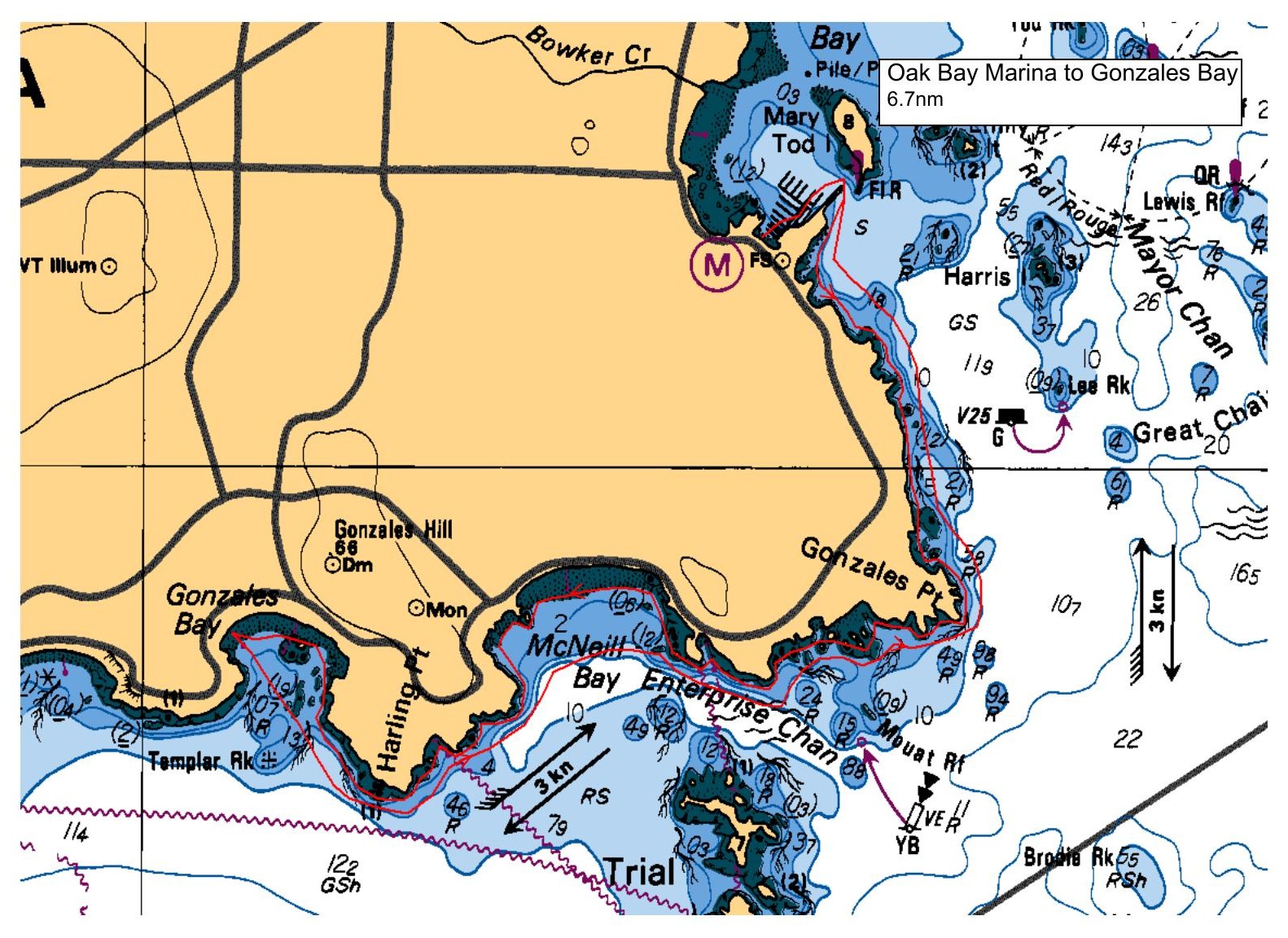
This relaxed paddle will follow the Oak Bay/Victoria shoreline until we get to Gonzales Beach, where we will have lunch. There is a washroom at the top of Gonzales Beach. On the way back we'll roughly follow the same route, but maybe a bit more direct. This is a fun route with lots of mini islands and rocks to sneak around. In keeping with the relaxed format we will not be venturing out to Trial Island.
Requests to join the paddle will be collected for 2 days after the email announcement. If the paddle is over-subscribed, a random draw will be made to select paddlers for the trip. Everyone will be notified within 3 days if they are on the paddle or the waitlist. Spam folders will be checked !
Route plan B
Telegraph Cove to Cormorant Point
Safety reminders
Always dress for the possibility of immersion and please bring a drybag containing a spare change of clothes. The drybag goes in your kayak with you, not in your car at the launch site. Please bring a lunch or snacks and sufficient beverage to keep you hydrated, as well as a thermos of something warm. Your paddle leader will introduce the plan and make sure everyone is comfortable with the requirements. Please stay off the water until the group is ready. If you have a VHF radio please bring it with you.
SISKA · Paddle · Relaxed
Printed Nov 9, 2026 11:21 AM · siska.ca/activities/1597
Oak Bay Marina to Gonzales Bay - TOO WINDY AND PLAN B LAUNCH WAS LOG
Sunday, January 4, 2026 · 9:30 AM – 3:30 PM
Cancelled
Launch
Oak Bay MarinaOak Bay Marina
Destination
Gonzales Bay
Leader
Mike Teachman
Route plan A
This relaxed paddle will follow the Oak Bay/Victoria shoreline until we get to Gonzales Beach, where we will have lunch. There is a washroom at the top of Gonzales Beach. On the way back we'll roughly follow the same route, but maybe a bit more direct. This is a fun route with lots of mini islands and rocks to sneak around. In keeping with the relaxed format we will not be venturing out to Trial Island.
Requests to join the paddle will be collected for 2 days after the email announcement. If the paddle is over-subscribed, a random draw will be made to select paddlers for the trip. Everyone will be notified within 3 days if they are on the paddle or the waitlist. Spam folders will be checked !
Route plan B
Telegraph Cove to Cormorant Point
Route map
Oak Bay Marina to Gonzales Bay - TOO WINDY AND PLAN B LAUNCH WAS LOG · Sunday, January 4, 2026