Paddle Light

Shoreline Drive Boat Ramp to Portage Inlet Tour

Shoreline Boat ramp to Portage Inlet and Gorge Waterway

When Saturday, August 15, 2026 9:30 AM – 3:30 PM
Location Shoreline Drive Boat Ramp
2 of 7 open Free
Destination Portage Inlet Tour
Trip style Day
Experience Basic
Distance 5.2 nm
Route plan A

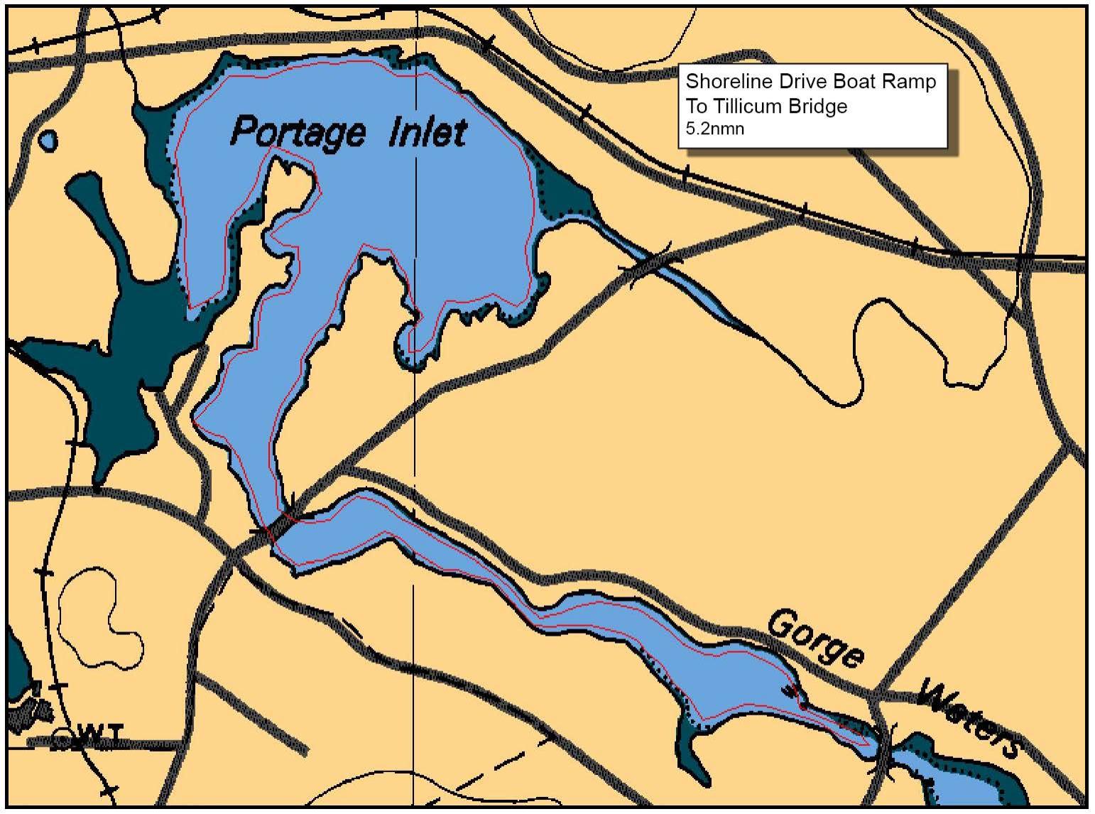
We will launch from the Shoreline School boat ramp and paddle out to Portage Inlet then down the Gorge Waterway to Esquimalt Gorge Park for a snack/lunch/bio break.

High tide 3.5 ft @ 5:40am, Low tide 1.3 ft @ 1:37 pm so tide will be ebbing for the paddle.

Contact Marika marika726@gmail.com for more info.

Route plan B

TBA

Safety reminders

Always dress for the possibility of immersion and please bring a drybag containing a spare change of clothes. The drybag goes in your kayak with you, not in your car at the launch site. Please bring a lunch or snacks and sufficient beverage to keep you hydrated, as well as a thermos of something warm. Your paddle leader will introduce the plan and make sure everyone is comfortable with the requirements. Please stay off the water until the group is ready. If you have a VHF radio please bring it with you.

Shoreline Drive Boat Ramp tide/current reference

Sources & licences

Tide & current predictions

CHS provides tide heights and current predictions. Secondary current stations are estimates; large-tide estimates are identified separately. Tide turns and slack water are independent. Conditions along the route vary with location.

CHS atlas & lookup licences

Canadian Atlas of Tidal Currents, Volume 3: Juan de Fuca Strait to Strait of Georgia (2016), Canadian Hydrographic Service, Fisheries and Oceans Canada. © Her Majesty the Queen in Right of Canada, 2022.

Map images are reproduced from the CHS publication and selected for the date and time shown. The publication permits noncommercial reproduction in any format; commercial reproduction requires prior written permission from CHS. This viewer is not an official CHS publication and is not to be used for navigation.

Current Atlas Lookup Tables: Juan de Fuca Strait to Strait of Georgia by Emanuel Borsboom. SISKA adapts the tables to show selected hours and atlas page numbers. The original tables and these adapted tables are provided under Creative Commons Attribution-NonCommercial-ShareAlike 2.5 Canada (CC BY-NC-SA 2.5 CA).

Dewey atlas attribution

Salish Sea Tidal Current Atlas and calendar lookup tables by Richard K. Dewey, self-published. The selected volume and map number are shown in the viewer. SISKA displays extracted map images and selects them using the author's lookup tables.

For recreational reference only. Not for navigation. These products are not endorsed by CHS or NOAA and are not official Canadian or US government publications. Use current official charts and publications for navigation.

Confirm

Confirm action

Are you sure?

SISKA · Paddle · Light

Printed Nov 2, 2026 6:36 AM · siska.ca/activities/1654

Shoreline Drive Boat Ramp to Portage Inlet Tour

Saturday, August 15, 2026 · 9:30 AM – 3:30 PM

Launch
Shoreline Drive Boat Ramp
Destination
Portage Inlet Tour
Distance
5.2 nm
Leader
Marika Stephenson

Route plan A

We will launch from the Shoreline School boat ramp and paddle out to Portage Inlet then down the Gorge Waterway to Esquimalt Gorge Park for a snack/lunch/bio break.

High tide 3.5 ft @ 5:40am, Low tide 1.3 ft @ 1:37 pm so tide will be ebbing for the paddle.

Contact Marika marika726@gmail.com for more info.

Route plan B

TBA