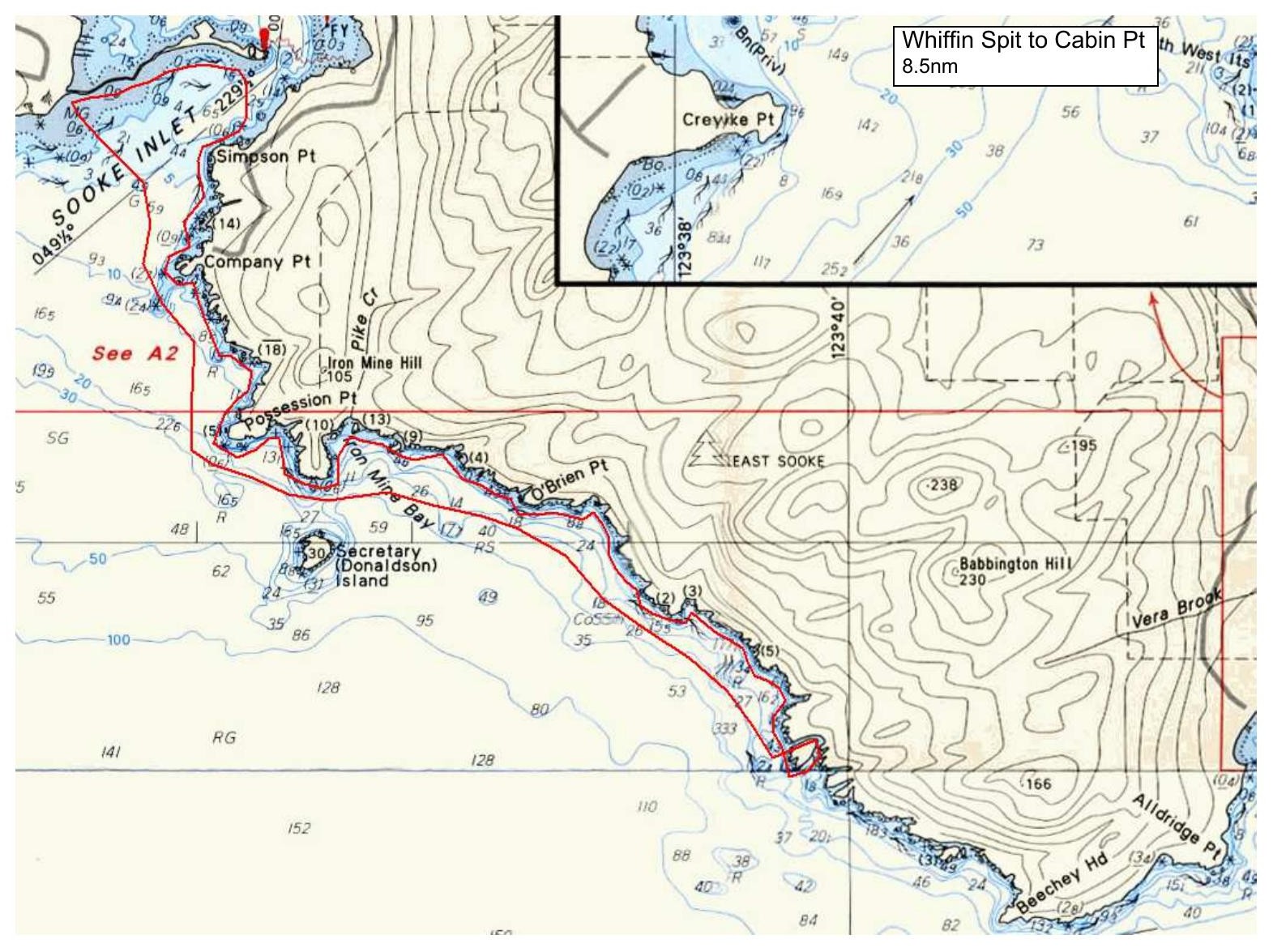
Depending on conditions we will launch from the ocean side or the Sooke Basin side of Whiffin Spit below the parking lot, paddle out and cross the channel to the East Sooke coastline. We will then follow the rugged shoreline closely, passing Company Pt, Possession Pt. and Iron Mine Bay en route to Cabin Point Conditions permitting, we will land at Cabin Point for lunch and then return by the same route.
There will be opportunities for rock gardening along the coastline, so bring a helmet if this interests you.
Parking at Whiffin Spit is limited so consider car pooling with a friend.
Route plan B
If the weather does not cooperate, we will paddle around Sooke Basin, possibly with a side trip up the Sooke River.
Safety reminders
Always dress for the possibility of immersion and please bring a drybag containing a spare change of clothes. The drybag goes in your kayak with you, not in your car at the launch site. Please bring a lunch or snacks and sufficient beverage to keep you hydrated, as well as a thermos of something warm. Your paddle leader will introduce the plan and make sure everyone is comfortable with the requirements. Please stay off the water until the group is ready. If you have a VHF radio please bring it with you.
SISKA · Paddle · Energizer
Printed Nov 9, 2026 10:59 AM · siska.ca/activities/1379
Whiffin Spit to Cabin Point
Sunday, May 28, 2023 · 9:30 AM – 3:30 PM
Launch
Whiffin SpitWhiffin Spit Road
Destination
Cabin Point
Distance
8.5 nm
Leader
Anton Cepeliauskas
Route plan A
Depending on conditions we will launch from the ocean side or the Sooke Basin side of Whiffin Spit below the parking lot, paddle out and cross the channel to the East Sooke coastline. We will then follow the rugged shoreline closely, passing Company Pt, Possession Pt. and Iron Mine Bay en route to Cabin Point Conditions permitting, we will land at Cabin Point for lunch and then return by the same route.
There will be opportunities for rock gardening along the coastline, so bring a helmet if this interests you.
Parking at Whiffin Spit is limited so consider car pooling with a friend.
Route plan B
If the weather does not cooperate, we will paddle around Sooke Basin, possibly with a side trip up the Sooke River.
Route map
Whiffin Spit to Cabin Point · Sunday, May 28, 2023