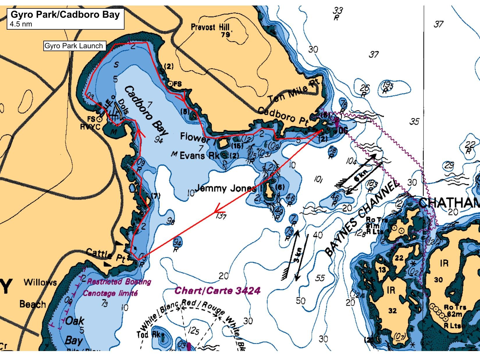
This will be a relaxed paddle following the shoreline and sheltered from any currents. Multiple take-out spots are available. Currently (Wednesday morning), a mix of sun and cloud and a high of 17 C is forecast. It will always be cooler over the water. Winds are forecast from the west, light at launch and increasing to about 10 knots by take-out. We will follow a clockwise route and do the bay crossing while winds are still light. There are full washrooms at Gyro Park and a coffee and debriefing spot available in the village.
Route plan B
TBA
Safety reminders
Always dress for the possibility of immersion and please bring a drybag containing a spare change of clothes. The drybag goes in your kayak with you, not in your car at the launch site. Please bring a lunch or snacks and sufficient beverage to keep you hydrated, as well as a thermos of something warm. Your paddle leader will introduce the plan and make sure everyone is comfortable with the requirements. Please stay off the water until the group is ready. If you have a VHF radio please bring it with you.
SISKA · Paddle · Relaxed
Printed Nov 9, 2026 10:59 AM · siska.ca/activities/1546
Cadboro Bay - UPLANDS EXPLORATION
Saturday, May 10, 2025 · 9:30 AM – 3:30 PM
Launch
Cadboro Bay2600 Sinclair Rd, Victoria
Destination
Cadboro Bay
Distance
4.5 nm
Leader
Norman Noel
Route plan A
This will be a relaxed paddle following the shoreline and sheltered from any currents. Multiple take-out spots are available. Currently (Wednesday morning), a mix of sun and cloud and a high of 17 C is forecast. It will always be cooler over the water. Winds are forecast from the west, light at launch and increasing to about 10 knots by take-out. We will follow a clockwise route and do the bay crossing while winds are still light. There are full washrooms at Gyro Park and a coffee and debriefing spot available in the village.
Route plan B
TBA
Route map
Cadboro Bay - UPLANDS EXPLORATION · Saturday, May 10, 2025