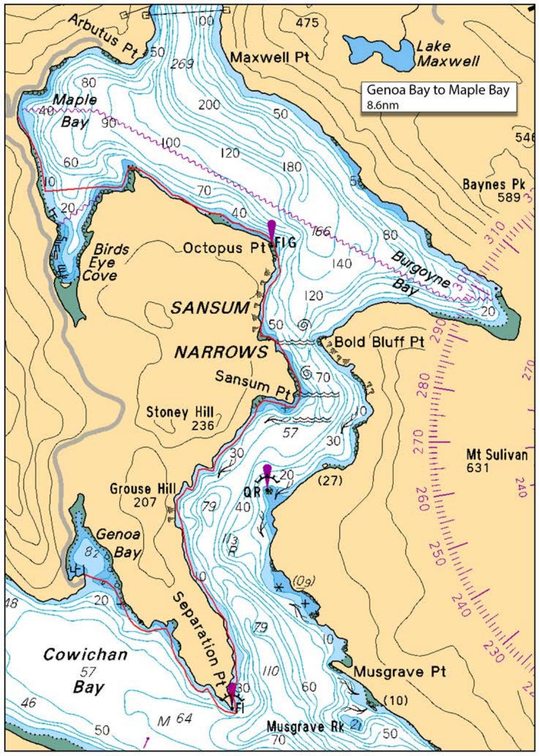
Assuming the weather cooperates, we will launch from Genoa Bay and make our way around Separation point to catch a bit of a flood current towards Sansum Narrows. We will likely take a short break before we hit the Narrows, then will continue through to Octopus Point, Paddy's Mile Stone and reach Maple Bay to land at about 2:30 pm.
The current as we pass through Sansum Narrows should be ~3 knots, so be prepared for turbulent waters. Immersion wear is required for this paddle.
We will meet at launch site at Genoa Bay by 09:15 as we will need to shuttle some vehicles to Maple Bay for the end-of-day transfers.
Route plan B
TBA
Safety reminders
Always dress for the possibility of immersion and please bring a drybag containing a spare change of clothes. The drybag goes in your kayak with you, not in your car at the launch site. Please bring a lunch or snacks and sufficient beverage to keep you hydrated, as well as a thermos of something warm. Your paddle leader will introduce the plan and make sure everyone is comfortable with the requirements. Please stay off the water until the group is ready. If you have a VHF radio please bring it with you.
SISKA · Paddle · Energizer
Printed Nov 9, 2026 10:59 AM · siska.ca/activities/1578
Genoa Bay to Maple Bay - ONE WAY
Saturday, October 4, 2025 · 9:15 AM – 3:15 PM
Cancelled
Launch
Genoa BayGenoa Bay
Destination
Maple Bay
Leader
Rich Weir
Route plan A
Assuming the weather cooperates, we will launch from Genoa Bay and make our way around Separation point to catch a bit of a flood current towards Sansum Narrows. We will likely take a short break before we hit the Narrows, then will continue through to Octopus Point, Paddy's Mile Stone and reach Maple Bay to land at about 2:30 pm.
The current as we pass through Sansum Narrows should be ~3 knots, so be prepared for turbulent waters. Immersion wear is required for this paddle.
We will meet at launch site at Genoa Bay by 09:15 as we will need to shuttle some vehicles to Maple Bay for the end-of-day transfers.
Route plan B
TBA
Route map
Genoa Bay to Maple Bay - ONE WAY · Saturday, October 4, 2025