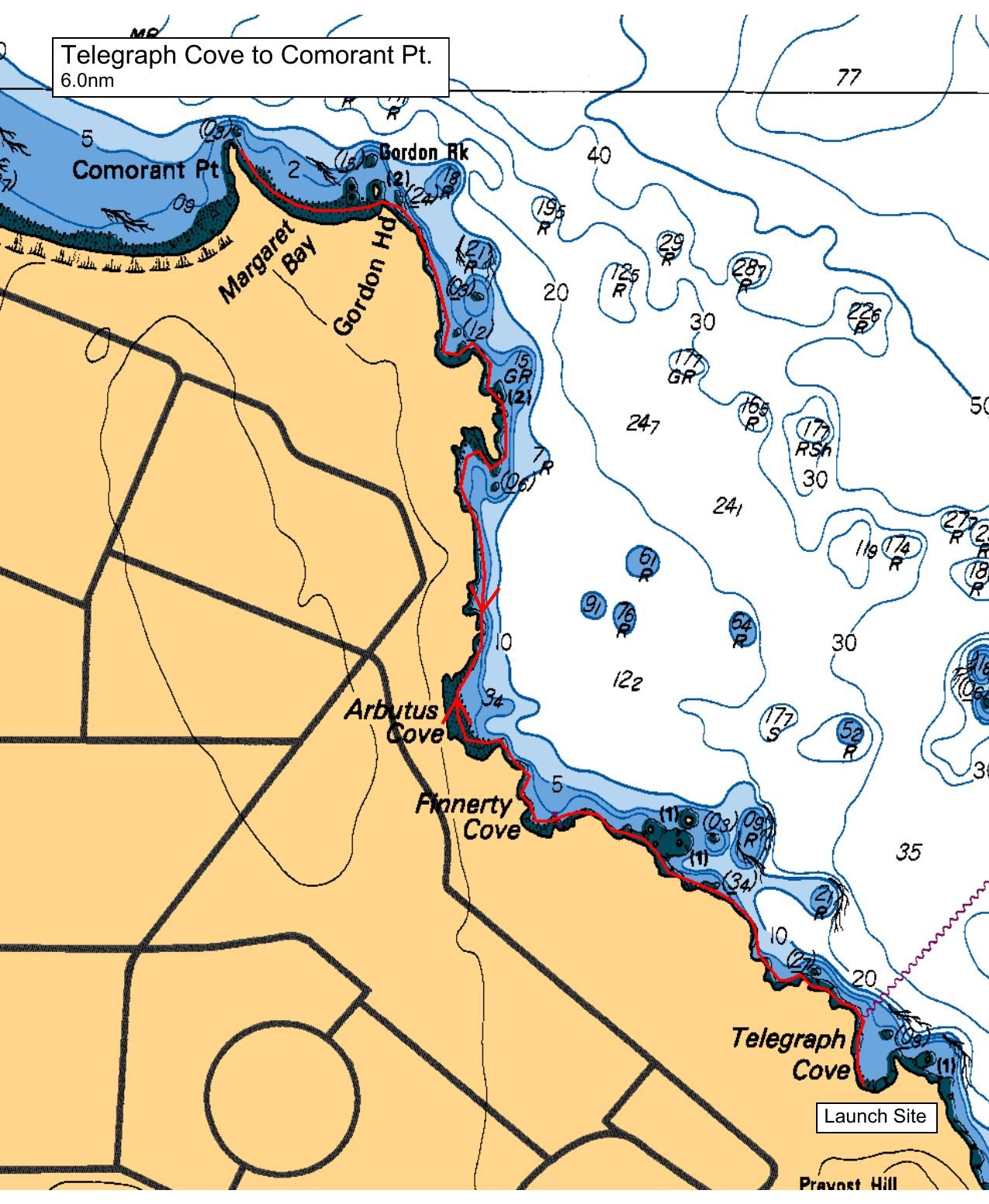
Come paddle the Gordon Head coastline and see the area from a different perspective. In the 1960s this area was field, forest, berry and flower fields with very few homes on large lots. Development through the 1990s has filled in much of the green space and provided park access along the shore. But on the water, there is much to explore and enjoy.
Come join me for the Gordon Head coastline tour.
PS For those driving a longer distance, Cadboro Bay's Gyro Park offers a nearby last washroom opportunity.
Route plan B
Wind from the south or east will make our Plan A an exposed bit of paddling. We'll decamp for a launch at Cadboro Bay and a tour of the Oak Bay coastline or we'll move our paddle to Brentwood Bay if conditions are unusually (for September) windy or rough.
Plan C is Coffee and Cake at Mocha House in Cadboro Bay Village.
Safety reminders
Always dress for the possibility of immersion and please bring a drybag containing a spare change of clothes. The drybag goes in your kayak with you, not in your car at the launch site. Please bring a lunch or snacks and sufficient beverage to keep you hydrated, as well as a thermos of something warm. Your paddle leader will introduce the plan and make sure everyone is comfortable with the requirements. Please stay off the water until the group is ready. If you have a VHF radio please bring it with you.
SISKA · Paddle · Relaxed
Printed Nov 2, 2026 4:59 AM · siska.ca/activities/1661
Telegraph Cove to Margaret Bay
Sunday, September 20, 2026 · 9:15 AM – 3:15 PM
Launch
Telegraph Cove4040 Lockehaven Dr
Destination
Margaret Bay
Distance
6 nm
Leader
Norman Noel
Route plan A
Come paddle the Gordon Head coastline and see the area from a different perspective. In the 1960s this area was field, forest, berry and flower fields with very few homes on large lots. Development through the 1990s has filled in much of the green space and provided park access along the shore. But on the water, there is much to explore and enjoy.
Come join me for the Gordon Head coastline tour.
PS For those driving a longer distance, Cadboro Bay's Gyro Park offers a nearby last washroom opportunity.
Route plan B
Wind from the south or east will make our Plan A an exposed bit of paddling. We'll decamp for a launch at Cadboro Bay and a tour of the Oak Bay coastline or we'll move our paddle to Brentwood Bay if conditions are unusually (for September) windy or rough.
Plan C is Coffee and Cake at Mocha House in Cadboro Bay Village.
Route map
Telegraph Cove to Margaret Bay · Sunday, September 20, 2026